|
Observation type
Avalanche Observer Jimmy Guilinger Keep me anonymous if published no Location (general area) Mount Baden Powell (NE coulouirs above Big Horn trail and Lamel Spring gully) Latitude 34.36886 Longitude -117.75508 Date (yyyymmdd) 20210228 Time 2pm Road conditions to area clear Temperature 30-40 deg F Sky clear (no clouds) Wind speed Moderate (17-25mph Small trees sway/ flags stretched) Wind direction not observed Wind direction in degrees Slope aspect North Aspect in degrees NE couloirs and N gully (Lamel Springs) Slope angle ~30 degrees in Lamel Gully and ~40 degrees in NE couloirs Elevation 7000-8500' Snow depth Multiple feet in N-facing gullies, dry on southerly aspects Boot/ Ski penetration Moderate surface penetration Precipitation None Activity, recent avalanches yes Brief description Wet avalanche runout debris (probably from earlier in the week during warm period based on previous reports) Whumphing noises, shooting cracks. collapsing no Rapid warming no Obvious avalanche path yes Terrain trap yes Comment While ascending NE couloirs of Baden Powell on Sunday morning 2/28/21, observed two distinct wet avalanche runouts/deposits (likely from earlier in the week during warm period based on previous observations posted to website). Avalanche debris reformed into ice clasts as observed by clinking by ice axe/crampons. Approx lat/long: 34.361541, -117.749394 (no photos taken) Additionally, while descending on foot/glissading along Lamel Spring gully observed (and photographed, see attached) two distinct avalanche deposition zones and an obvious source area (also likely triggered during previous warm spell, 2nd photo showing bare ground source area). This debris was also refrozen-clasts and notably contained significant woody material and rocks in line with source area showing scour all the way to bare surface. Approx lat/long: 34.36886, -117.75508 Publish this observation Yes I would like this observation Published |
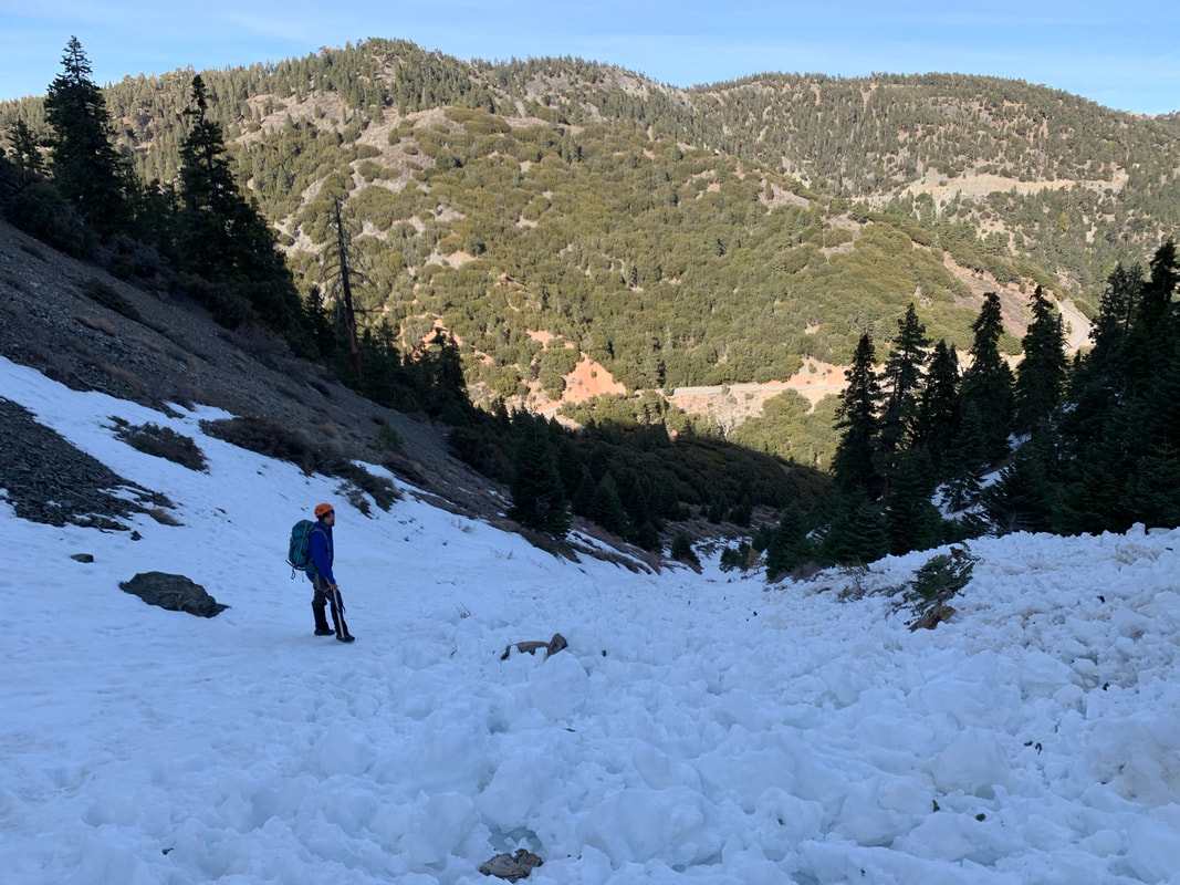
Avy runout debris #1 (climber shown for scale)
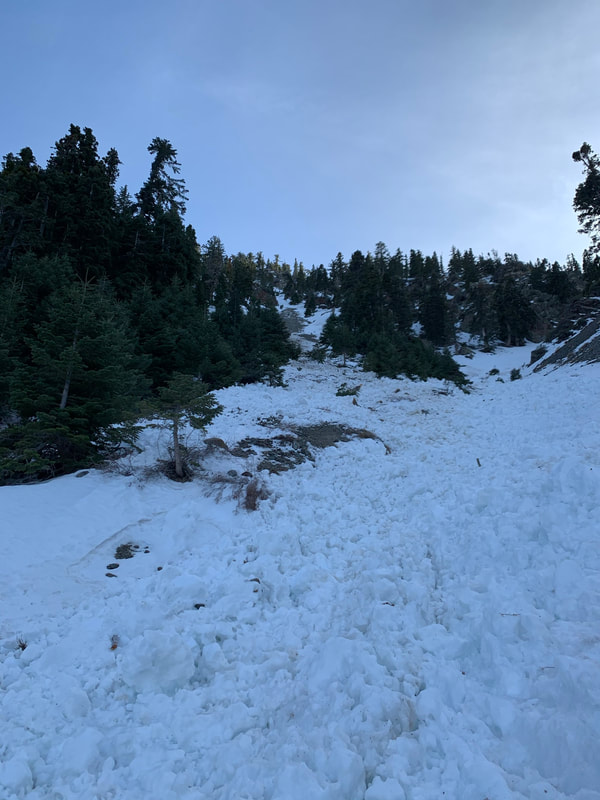
Avy runout #2 with source area
|
Sponsors
|
|
|
|

|

|

|

|

|

|

|
|

|
|
|
|

|

|
Supporters
|
|
|
|

|
|
© 2013 - 2015 So Cal Snow Avalanche Center inc. All rights reserved.
P.O.Box 214 Tujunga, Ca. 91043 |
A 501(c)3 non profit organization # 46-2296801
|
Use at your own risk. This information is provided “as is” and in no event shall the providers be liable for any damages, including, without limitation, damages resulting from discomfort, injury or death, claims by third parties or for other similar costs, or any special, incidental, or consequential damages, arising out of the use of the information.