|
Observation type
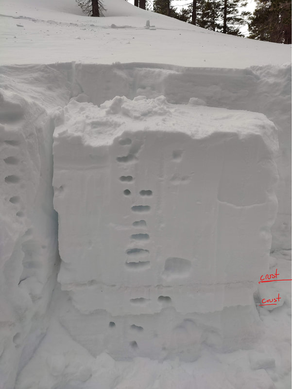
Snowpack Observer Anonymous Keep me anonymous if published yes Location (general area) San Gorgonio Wilderness, Alto Diablo Latitude 34.12710 Longitude -116.86445 Date (yyyymmdd) 20230108 Time 1400 Road conditions to area Temperature Sky Scattered clouds (3/8 to 4/8) Wind speed not observed Wind direction not observed Wind direction in degrees Slope aspect North East Aspect in degrees Slope angle Elevation 10500 Snow depth 150 cm Boot/ Ski penetration Activity, recent avalanches No Brief description Comment Riding and skinning up the ridge from South Fork trailhead to Alto Diablo was difficult below ~8500 feet due to only a few inches of snow on top of bushes. ~150cm deep pit. Starting from the base, a few inches is ice melt-freeze crust. Then ~6 inches of finger hardness. Crust (failure at this layer). ~4 inches of 4finger+. Another crust. ~4 feet of slab ranging from 4finger to fist. On top of that ~1 inch of stiffer wind affected snow, unknown hardness. The column test did not fail on compression BUT this may have been due to poor isolation on the back of the column. The slab popped off at the bottom crust when pulling it down. Publish this observation Yes I would like this observation Published |
Sponsors
Supporters
|
© 2013 - 2015 So Cal Snow Avalanche Center inc. All rights reserved.
P.O.Box 214 Tujunga, Ca. 91043 |
A 501(c)3 non profit organization # 46-2296801
|
Use at your own risk. This information is provided “as is” and in no event shall the providers be liable for any damages, including, without limitation, damages resulting from discomfort, injury or death, claims by third parties or for other similar costs, or any special, incidental, or consequential damages, arising out of the use of the information.


