|
Observation type
Snowpack Observer Annonymous Keep me anonymous if published yes Location (general area) Big Pines Latitude Longitude Date (yyyymmdd) 20230131 Time 0730 Road conditions to area clear Temperature 14F Sky few clouds (up to 2/8) Wind speed Moderate (17-25mph Small trees sway/ flags stretched) Wind direction NE Wind direction in degrees Slope aspect West Aspect in degrees Slope angle 30 Elevation 7500ft Snow depth Boot/ Ski penetration Precipitation None Activity, recent avalanches No Brief description Whumphing noises, shooting cracks. collapsing yes Rapid warming no Obvious avalanche path no Terrain trap no Comment Sunrise tour on Tuesday 1-31 following the Sun-Mon storm cycle. Approx 15-20cm of cold, low density (for socal) fell total above 7000ft (likely more above 8500'), mostly on a surface of firm melt/freeze crust. Temp was 15F at 7k at 0700, colder as I went higher. Temps are in the high 20s at 6400' as of 12pm Tuesday. E-NE winds were blowing steadily as I reached a N-S ridgeline, where sastrugi (see photo) and snow transport was evident. Turns down the adjacent 30deg W-NW slope were as enjoyable as anything this year. Snow was soft, cold, and right side up; did not scrape or hit bottom once. However, small pockets shallow wind slabs were forming on the lee side of the ridge (see photo), but did not propagate beyond my ski tips. I suspect higher elevation and more wind loaded areas will be of greater concern. Coverage is looking pretty good at the moment, and it will be interesting to see how the projected dry spell affects the current snowpack in the days ahead. Publish this observation Yes I would like this observation Published |
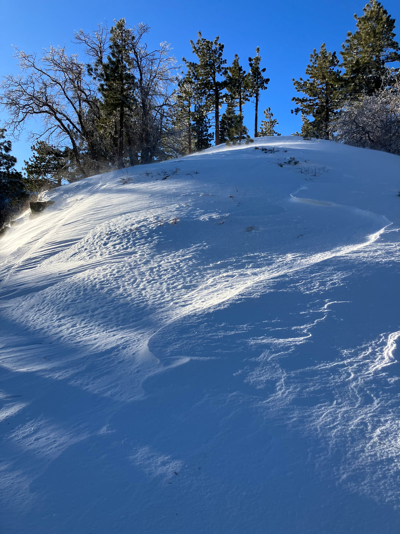
sastrugi
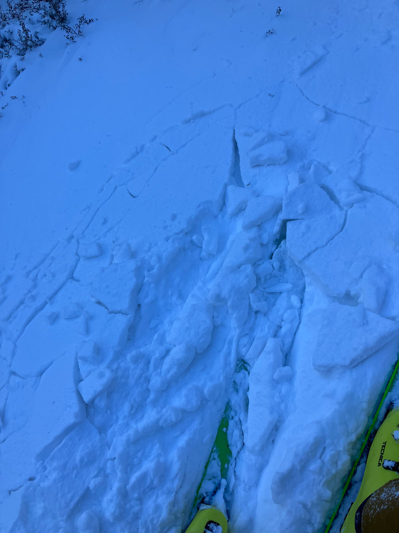
wind slab
|
Sponsors
|
|
|
|

|

|

|

|

|

|

|
|

|
|
|
|

|

|
Supporters
|
|
|
|

|
|
© 2013 - 2015 So Cal Snow Avalanche Center inc. All rights reserved.
P.O.Box 214 Tujunga, Ca. 91043 |
A 501(c)3 non profit organization # 46-2296801
|
Use at your own risk. This information is provided “as is” and in no event shall the providers be liable for any damages, including, without limitation, damages resulting from discomfort, injury or death, claims by third parties or for other similar costs, or any special, incidental, or consequential damages, arising out of the use of the information.