|
Observation type
Snowpack Observer Nicholas Moede Keep me anonymous if published no Location (general area) San Bernardino Mountains, Alto Diablo Latitude Longitude Date (yyyymmdd) 20230215 Time 10:00am Road conditions to area Clear Temperature 20 Sky clear (no clouds) Wind speed Moderate (17-25mph Small trees sway/ flags stretched) Wind direction not observed Wind direction in degrees Slope aspect North Aspect in degrees 0 Slope angle 28 Elevation 8000 Snow depth 30" Boot/ Ski penetration Precipitation None Brief description Whumphing noises, shooting cracks. collapsing yes Comment On February 15, 2023 I skinned up the north side of Alto Diablo on my skis. I observed shooting cracks and whumps on two slopes. On one of the slopes the crack propagated about 10 feet above me and 20 to 30 feet across the slope. If this had been on a steeper slope I believe it would have released a significant slab approximately 8 - 10" deep. This appears to be an old layer that is collapsing underneath the surface crust. This was only observed at lower elevations. Use caution moving through avalanche terrain at lower north facing elevations, especially on slopes exceeding 35 degrees. Additionally there were many areas of wind loaded snow at all elevations and a lot of snow could be seen blowing off the ridges above 10,000 feet. Even though the recent storm only brought about 1 - 2" of new snow to the area, the potential for windslabs around ridge lines is currently high. Avoid slopes above 30 degrees where wind loaded snow could accumulate especially near ridge lines. Publish this observation Yes I would like this observation Published |
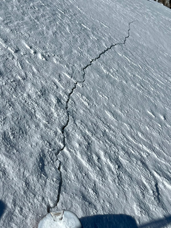
shootingcrack
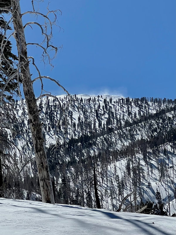
windloading
|
Sponsors
|
|
|
|

|

|

|

|

|

|

|
|

|
|
|
|

|

|
Supporters
|
|
|
|

|
|
© 2013 - 2015 So Cal Snow Avalanche Center inc. All rights reserved.
P.O.Box 214 Tujunga, Ca. 91043 |
A 501(c)3 non profit organization # 46-2296801
|
Use at your own risk. This information is provided “as is” and in no event shall the providers be liable for any damages, including, without limitation, damages resulting from discomfort, injury or death, claims by third parties or for other similar costs, or any special, incidental, or consequential damages, arising out of the use of the information.