|
Observation type
Snowpack Observer Anonymous Keep me anonymous if published yes Location (general area) Eastern San Gabriels Latitude Longitude Date (yyyymmdd) 20230115 Time 0700 Road conditions to area clear Temperature 25F Sky Overcast (sky covered) Wind speed Moderate (17-25mph Small trees sway/ flags stretched) Wind direction S Wind direction in degrees Slope aspect North West Aspect in degrees Slope angle Elevation 8200' Snow depth variable Boot/ Ski penetration Precipitation Light Activity, recent avalanches No Brief description Whumphing noises, shooting cracks. collapsing no Rapid warming no Obvious avalanche path no Terrain trap no Comment Sunrise tour on 1-15-2023 with hopes of finding a few inches of soft snow above 8000ft were met instead with refrozen wintry mix, rime ice and breakable crust. Coverage above 7900ft was decent on NE to NW aspects, with evidence of snow transport apparent on steeper road cuts and behind fallen trees. Many NW slopes near the windward ridge were scraped down to a layer of boilerplate ice (see photo of rime rice on bush protruding through). Stomping on a few test slopes yielded small failures a few cm deep on top of the rain crust yesterday's snow fell onto. Higher altitude, steeper, and/or slopes that received more snow will likely have more significant wind slab issues. Overall, this storm was kind of a bust in the Eastern SG mountains, and consistent with this winter's theme of rain/wintry mix up to 7000' and above on many of our wettest storms. Fingers crossed the next system is colder, as advertised. Publish this observation Yes I would like this observation Published |
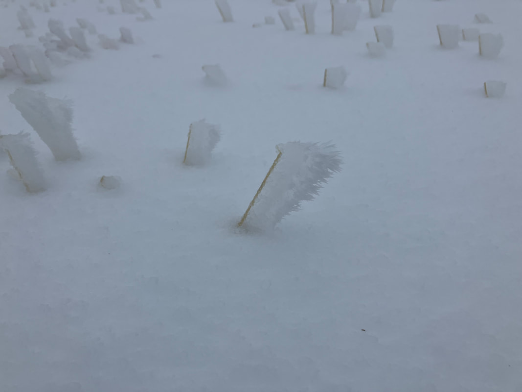
rime ice
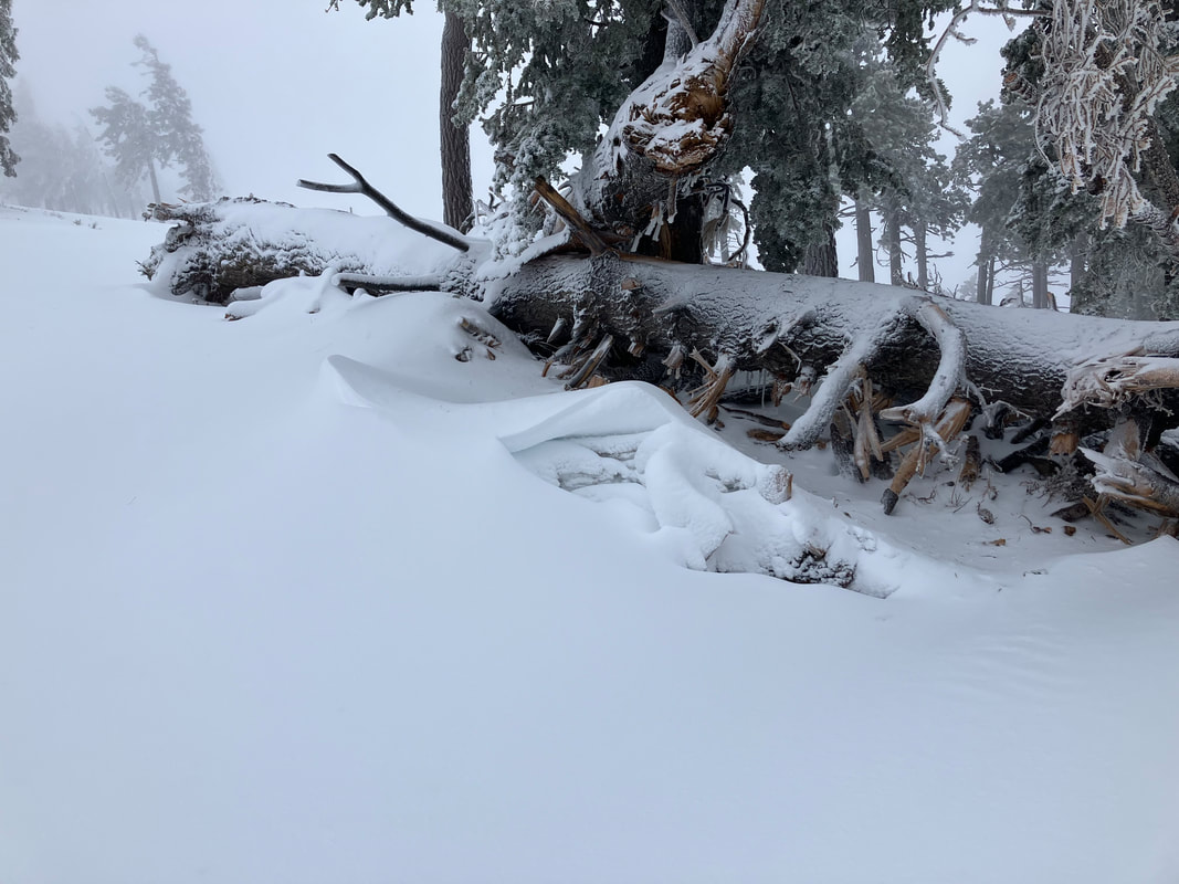
wind loading
|
Sponsors
|
|
|
|

|

|

|

|

|

|

|
|

|
|
|
|

|

|
Supporters
|
|
|
|

|
|
© 2013 - 2015 So Cal Snow Avalanche Center inc. All rights reserved.
P.O.Box 214 Tujunga, Ca. 91043 |
A 501(c)3 non profit organization # 46-2296801
|
Use at your own risk. This information is provided “as is” and in no event shall the providers be liable for any damages, including, without limitation, damages resulting from discomfort, injury or death, claims by third parties or for other similar costs, or any special, incidental, or consequential damages, arising out of the use of the information.