|
Observation type
Snowpack Observer Anonymous Keep me anonymous if published yes Location (general area) Eastern San Gabriel Mountains Latitude Longitude Date (yyyymmdd) 20211218 Time 1200 Road conditions to area Temperature 34F Sky clear (no clouds) Wind speed Calm (smoke rises vertically) Wind direction not observed Wind direction in degrees Slope aspect North Aspect in degrees Slope angle 29 Elevation 7650ft Snow depth 30cm Boot/ Ski penetration Precipitation None Activity, recent avalanches Brief description Whumphing noises, shooting cracks. collapsing no Rapid warming no Obvious avalanche path no Terrain trap no Comment First local tour of the season on Saturday. Goal was to explore the higher elevation snowpack after last Tuesday's cold>warm>cold storm that had an initial snow level of around 7,300ft before dropping to 5,000ft in the late afternoon. I stopped about 400ft short of my planned ridgeline summit due to boilerplate ice throughout the crux of the ascent, which I was not prepared for (no ski crampons or axe). It was clear that the heavy winds and warm start of the storm played a significant role on the base that's been laid down: large swaths of refrozen wet slush and rime ice debris, pockets of wind drifted sugary snow, and scoured bare earth. Wind sheltered N-NW aspects were the most skiable, with a few cm of soft sugary snow that allowed for a few cautious turns. Pit dug at 7,650ft on a N aspect, 29 degree slope was telling. 30cm deep, pen hard from 0-15cm, knife hard 15-20cm, and soft faceted snow on the surface. That's consistent with how the storm evolved throughout Tuesday. The good news here is the rock hard base that went down last Tuesday is doing a very effective job of covering the rocks, bushes and stumps. The bad news is the cold, clear, windless nights following the storm have turned the surface into a massive facet farm on N and NW aspects. It will be interesting to see how the next storms bond to what's been laid down so far. Publish this observation Yes I would like this observation Published |
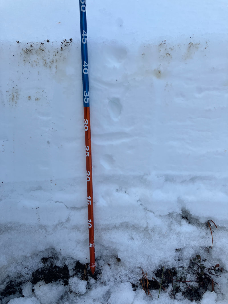
Pit
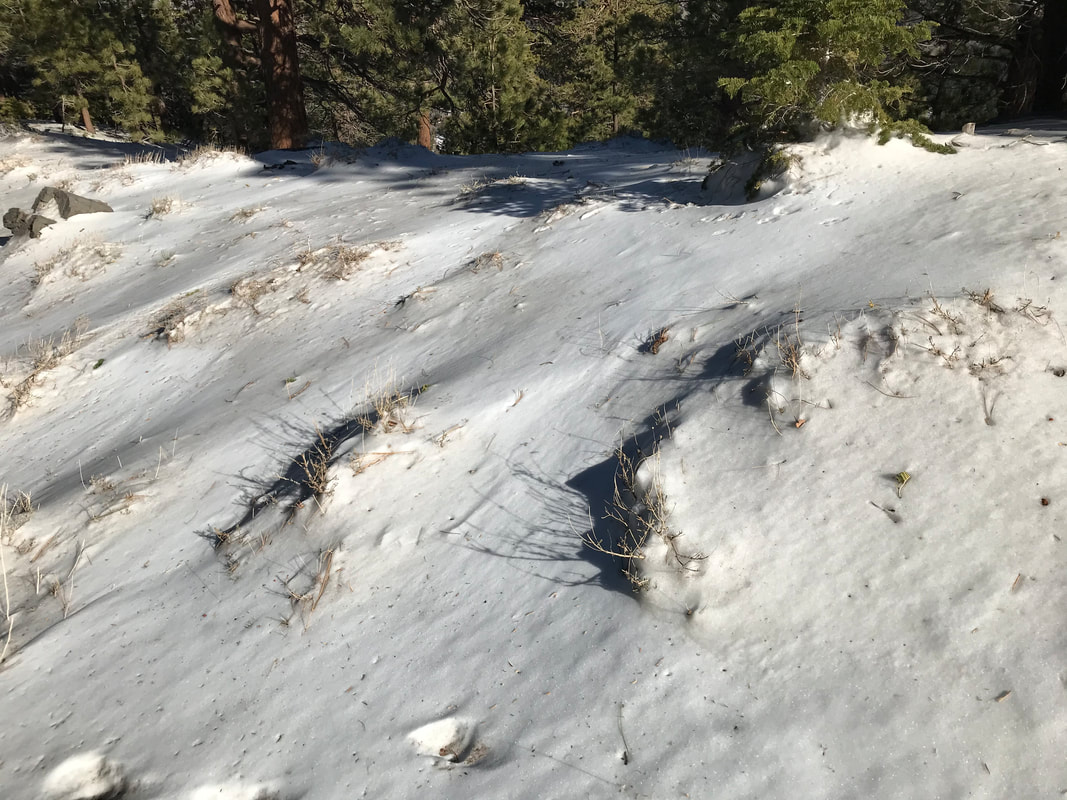
encapsulated bushes
|
Sponsors
|
|
|
|

|

|

|

|

|

|

|
|

|
|
|
|

|

|
Supporters
|
|
|
|

|
|
© 2013 - 2015 So Cal Snow Avalanche Center inc. All rights reserved.
P.O.Box 214 Tujunga, Ca. 91043 |
A 501(c)3 non profit organization # 46-2296801
|
Use at your own risk. This information is provided “as is” and in no event shall the providers be liable for any damages, including, without limitation, damages resulting from discomfort, injury or death, claims by third parties or for other similar costs, or any special, incidental, or consequential damages, arising out of the use of the information.