|
Observation type
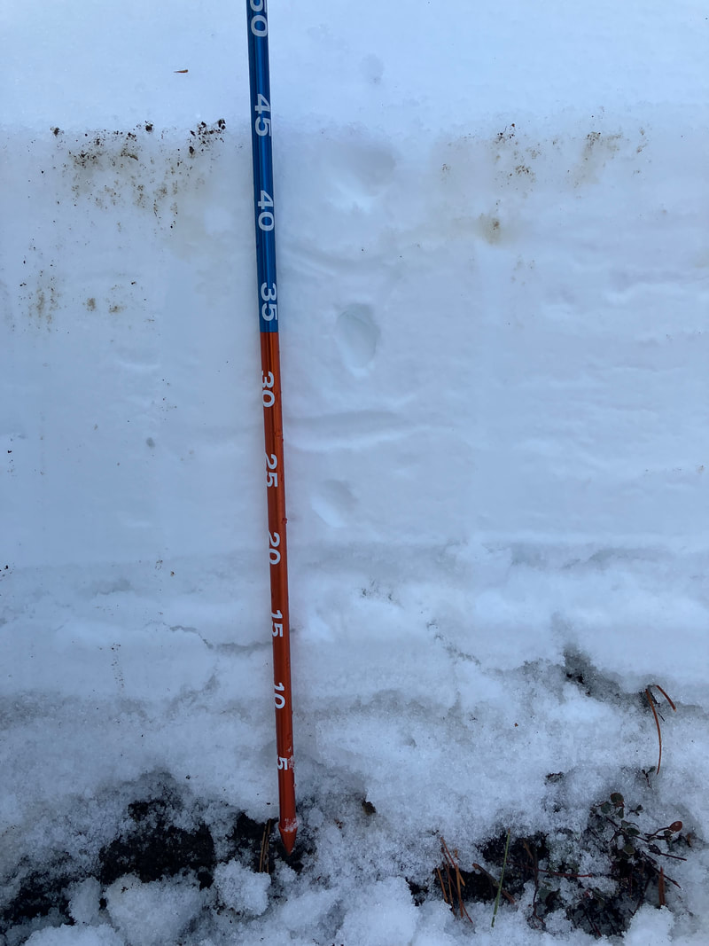
Snowpack Observer Anonymous Keep me anonymous if published yes Location (general area) Eastern San Gabriel Mountains Latitude Longitude Date (yyyymmdd) 20220226 Time 1130 Road conditions to area Temperature 37F Sky clear (no clouds) Wind speed Light (1-16mph Flags/twigs in motion) Wind direction NE Wind direction in degrees Slope aspect North East Aspect in degrees Slope angle 35 Elevation 7200ft Snow depth 75cm Boot/ Ski penetration Precipitation None Activity, recent avalanches No Brief description Whumphing noises, shooting cracks. collapsing no Rapid warming yes Obvious avalanche path no Terrain trap no Comment Headed out for a mellow local tour with modest expectations for what I'd find. To my surprise, snow conditions were excellent even after 2-3 days of clear weather. The very cold nature of the 2/22-2/23 storm, plus the cool days and cold nights that followed, seemed to keep the surface in prime shape. There were obvious locations of thin cover and bare earth, mostly on low-angle and sun affected aspects, but the steeper North facing aspects skied the best, with 10-20cm of soft fluffy powder. By noon, anything in direct sun was turning over to "hot pow" but still skied great. I suspect Sunday will be punchy and crusty given the quick warmup and milder overnight temps. I dug a pit on a 35 degree NNE test slope at 7200ft and was met with a surprisingly deep snowpack. 75cm deep. 1F snow from 55-75cm with a thin melt/freeze crust at 55cm; 1F snow from 40-55cm (ostensibly last week's storm) that showed signs of faceting, plus another thin crust at 40cm; 0-40cm pen hard remains of early season snowfall that also showed signs of faceting. I did a quasi-column test (forgot my saw...) and didn't see any evidence of obvious failures, but would take that with a grain of salt given the poor test execution. These findings were consistent with other recent observations on >7000ft North aspects, where anything under a clear sky and sheltered from the wind was converting over to a sugary texture, whereas any solar input resulted in more pronounced melt consolidation. Overall, the effect of more sunshine is becoming obvious in the local mountains, and the areas holding soft snow are becoming higher and steeper. It will be interesting to see how this week's warmup affect the current snowpack, and how that plays with any future storms (fingers crossed.) Publish this observation Yes I would like this observation Published |
Sponsors
Supporters
|
© 2013 - 2015 So Cal Snow Avalanche Center inc. All rights reserved.
P.O.Box 214 Tujunga, Ca. 91043 |
A 501(c)3 non profit organization # 46-2296801
|
Use at your own risk. This information is provided “as is” and in no event shall the providers be liable for any damages, including, without limitation, damages resulting from discomfort, injury or death, claims by third parties or for other similar costs, or any special, incidental, or consequential damages, arising out of the use of the information.


