|
Observation type
Snowpack/ Avalanche Observer Allen Giernet Keep me anonymous if published no Location (general area) Crystal Lake basin Angeles Forest Latitude Longitude Date (yyyymmdd) 20191227 Time 1022 Road conditions to area Plowed but icy at last two miles Temperature 0C Sky clear (no clouds) Wind speed Moderate (17-25mph Small trees sway/ flags stretched) Wind direction NW Wind direction in degrees Slope aspect West Aspect in degrees Slope angle 36 Elevation 7,485' Snow depth 93cm Boot/ Ski penetration 20cm SP Precipitation None Activity, recent avalanches yes Brief description 2 avalanches on west aspects near 7,800' & 1 on a South aspect Whumphing noises, shooting cracks. collapsing yes Rapid warming no Obvious avalanche path yes Terrain trap no Comment 5100’ 09:15 14-18” HS Wind C Sky C 09:40!snow falling off trees. Rapid warming 10:22 5,783’ 2.5’HS Noon avi debris W aspect some rocks. Probably yesterday eve 6,580’ looks to be about 800’ started off rocks above due to solar warming at the end of the day when the clouds cleared most likely. Observed a similar avalanche on another west aspect to the southeast of our location Another avalanche was observed in fairly due south aspect at a higher elevation some distance away. Probably from early today again originating at a rock band and most likely due to the solar influence. 13:30 WNW wind slab collapse and shooting cracks Tested another wind slab on a switch back and got some easy fracture. Windslabs were isolated but many on mostly on west to northwest aspects. Extensive signs of wind effects along ridges and lots of cross loading in gullies. Northwest winds picked up around 2:00 pm with significant wind transport. Upper ridges and peaks had large snow banners at times. Wind activity continued until after dark. Late afternoon on the way observed many small wet slabs off of rock areas and from trees dropping snow. Korea of roller balls. Mostly due south and southeast aspects. Publish this observation Yes I would like this observation Published |
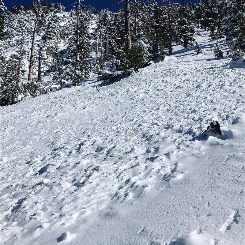
Avalanche Debris
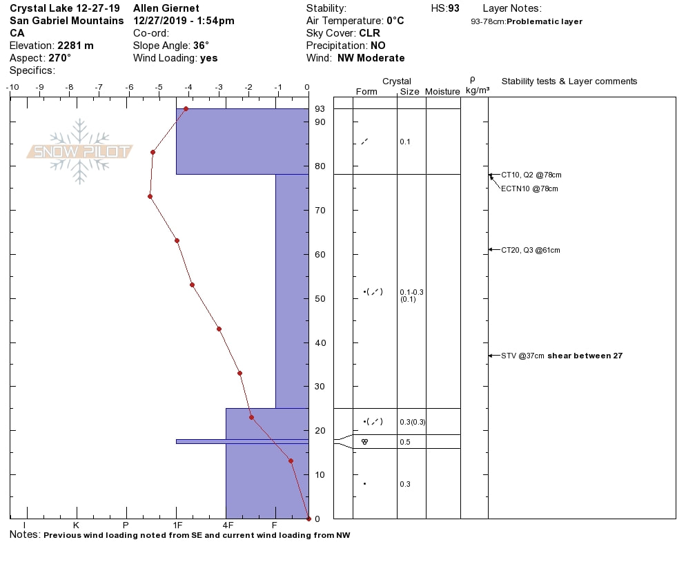
pit profile
|
Sponsors
|
|
|
|

|

|

|

|

|

|

|
|

|
|
|
|

|

|
Supporters
|
|
|
|

|
|
© 2013 - 2015 So Cal Snow Avalanche Center inc. All rights reserved.
P.O.Box 214 Tujunga, Ca. 91043 |
A 501(c)3 non profit organization # 46-2296801
|
Use at your own risk. This information is provided “as is” and in no event shall the providers be liable for any damages, including, without limitation, damages resulting from discomfort, injury or death, claims by third parties or for other similar costs, or any special, incidental, or consequential damages, arising out of the use of the information.