|
Observation type
Snowpack Observer Marcus Dufort Keep me anonymous if published no Location (general area) Silver Mountain Latitude 34.211245 Longitude -116.86092 Date (yyyymmdd) 20210313 Time 12:30PM Road conditions to area Clear until 4000'. Chain control, packed powder conditions all the way up to Big Bear Lake Temperature 37°F Sky clear (no clouds) Wind speed Light (1-16mph Flags/twigs in motion) Wind direction NE Wind direction in degrees Slope aspect North East Aspect in degrees Slope angle 24 Elevation 8,540 Snow depth 91 cm Boot/ Ski penetration 40 cm / 20 cm Precipitation None Activity, recent avalanches No Brief description Whumphing noises, shooting cracks. collapsing no Rapid warming no Obvious avalanche path no Terrain trap no Comment Posted Saturday morning after the March 11th storm. Rode the lifts to the top of Silver Mountain (Chair 4) at Big Bear Resort. Temps were cold today with no wind. Occasional 10 mph gust from the NE. Very light, dry powder. Calf-deep snowpack walking up to the pit site. Predicted a weak interface between new 14" snow and prior melt freeze crust. Tests showed very cohesive snowpack and unreactive. Very stable, only noticed a slight compressive shear between wind slab and storm layer. No propagation. Tried 3 tests. Results were ECTX, CTN and STN. I would still watch those crust interfaces and deeper faceted rounds for possible deep slab problems but considering today's NE aspect, the snowpack looks well bonded and cohesive throughout. Let's get some more! Publish this observation Yes I would like this observation Published |
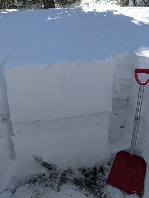
Snow pit dug down to ground powder over crust
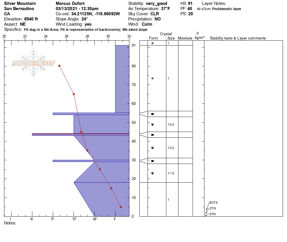
Pit profile
|
Sponsors
|
|
|
|

|

|

|

|

|

|

|
|

|
|
|
|

|

|
Supporters
|
|
|
|

|
|
© 2013 - 2015 So Cal Snow Avalanche Center inc. All rights reserved.
P.O.Box 214 Tujunga, Ca. 91043 |
A 501(c)3 non profit organization # 46-2296801
|
Use at your own risk. This information is provided “as is” and in no event shall the providers be liable for any damages, including, without limitation, damages resulting from discomfort, injury or death, claims by third parties or for other similar costs, or any special, incidental, or consequential damages, arising out of the use of the information.