|
Observation type - Snowpack
Observer - Allen Giernet Keep me anonymous if published - no Location (general area) - Mt. Baldy area i.e. manker flats to the resort/ devils backbone ridge Latitude Longitude Date (yyyymmdd) - 2014/03/02 Time - 7:30am - 3:00pm Road conditions to area - Clear Temperature - 36ºF/ 2.2ºC ⇑ 43ºF/ 6.1ºC Sky - Obscured (fog or base layer prevents view of sky) Wind speed - Light (1-16mph Flags/twigs in motion) Wind direction - not observed Wind direction in degrees Slope aspect - N/A Aspect in degrees - see below Slope angle - see below Elevation - see below Snow depth - variable noted below Boot/ Ski penetration - Ski P .5"/ 1.3cm to 2"/ 5cm Precipitation - None Activity, recent avalanches - yes Brief description - Roller ball activity from the previous day on W to SW slopes Whumphing noises, shooting cracks. collapsing - no Rapid warming - yes Comment - Road clear to Manker Flats… Remember boots when leaving house! 8:00 am sky was overcast at this time but good visibility, was able to see sun on Baldy on drive up through scattered clouds. Snow fairly solid at about 2"/ 5cm to 4"/ 10cm deep. (due to no boots decided to go up to resort and rent boots to travel and study snow) About 6500'/ 1980m to 7400'/ 2260m signs of rapid warming from the day before, heavy roller ball activity on W and SW slopes. 11:15am - 12 @ 7800'/ 2380m - 8400'/ 2560m 4"/ 10 cm - 8"/ 20cm heavy wet snow. Ski P - 1"/2.5cm Sky obscured due to low clouds very wet cloud condensation Southern slopes wind scoured especially near ridges/ Northern slopes signs of wind loading 12:30pm 8000'/ 2440m 7"/ 17cm snow on ridge top. Ski P - 1"/ 2.5 cm - 2" 5 cm SW facing slopes some wind scouring Trees at this time calving large chunks of ice/ snow Trees were heavily rimed on Southerly sides with ice all over… signs of the warm nature of the storm and lots of water prior to freezing temps. Visibility 100'/ 30m to 200'/ 60m and very wet conditions due to clouds 1:00 pm 8500'/ 2590m 5"/ 12cm to 6" 15 cm on ridge top. NW slope wind pillows and signs of loading visibility 100'/ 30m or less 1:30pm Devils Backbone ridge 8600'/ 2620m NE slope 52º angle 38º- 40º heavily wind loaded 8"/ 10cm to 2'/ 60cm SW slope 222º large wind lips at ridge top signs of wind scouring snow depth from a few inches to bare icy ground with pockets of 8"/ 10cm Angle 35º+ The snow was heavy and dense top to bottom no signs of layering and getting close to free water due to rapid warming 3:30pm trees at 6800'/ 2070m that were covered with snow and ice in the morning had dropped almost all the snow from their branches Publish this observation - Yes I would like this observation Published |
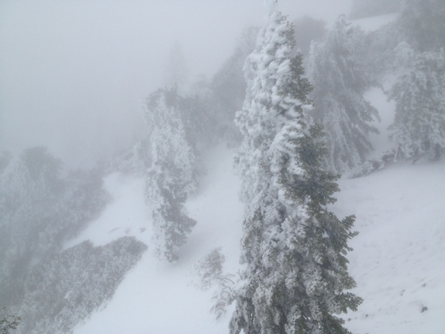
Rimed south facing trees
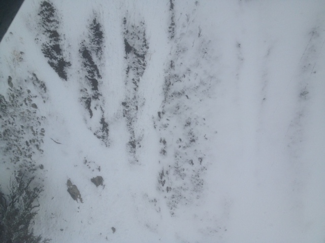
wind scouring
|
Sponsors
|
|
|
|

|

|

|

|

|

|

|
|

|
|
|
|

|

|
Supporters
|
|
|
|

|
|
© 2013 - 2015 So Cal Snow Avalanche Center inc. All rights reserved.
P.O.Box 214 Tujunga, Ca. 91043 |
A 501(c)3 non profit organization # 46-2296801
|
Use at your own risk. This information is provided “as is” and in no event shall the providers be liable for any damages, including, without limitation, damages resulting from discomfort, injury or death, claims by third parties or for other similar costs, or any special, incidental, or consequential damages, arising out of the use of the information.