|
Observation type - Snowpack
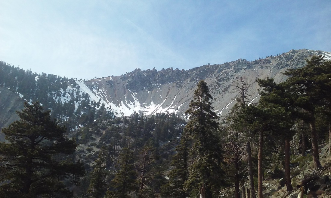
Observer - Greg Patrick Keep me anonymous if published - no Location (general area) - Baldy Bowl Date (yyyymmdd) - 20160302 Time - 10am Road conditions to area - clear Temperature - 60 Sky - clear (no clouds) Wind speed - not observed Wind direction - not observed Slope aspect - not observed Aspect in degrees - all Elevation - 8500 Snow depth - <1m Boot/ Ski penetration - 0"-6" Activity, recent avalanches - yes Brief description - hard ice crusts w/ very little softening Comment - Most of the snow is gone on south facing slopes but NE aspects are still holding hard snow/ice well. The coming storms will likely create short term - persistant snow stability problems above existing snow over the next week. New cold storms do not typically bond well to old hard layers so we'll have to wait and see how conditions develop. Temps Tues and Wed are supposed to be back into the 50s at the bowl again which will favor rapid snow stabilization. I took pics (attached) of the current snow so we'll know exactly where potential problems might arise. Current forecast is for about two feet of new snow down to 6000'. With wind this may put down over a meter in the trees on the west side of the bowl. Since there is still a solid ice layer holding on all north aspects above 7000', recommend avoiding any canyon (Big Butch, etc.) exposed to new snow over this layer. So to repeat: Stay out of the trees on the west side of the bowl, stay out of Big Butch and Ice House Canyons until conditions are stable which won't be until next weekend at the soonest. |
Sponsors
Supporters
|
© 2013 - 2015 So Cal Snow Avalanche Center inc. All rights reserved.
P.O.Box 214 Tujunga, Ca. 91043 |
A 501(c)3 non profit organization # 46-2296801
|
Use at your own risk. This information is provided “as is” and in no event shall the providers be liable for any damages, including, without limitation, damages resulting from discomfort, injury or death, claims by third parties or for other similar costs, or any special, incidental, or consequential damages, arising out of the use of the information.


