|
Observation type
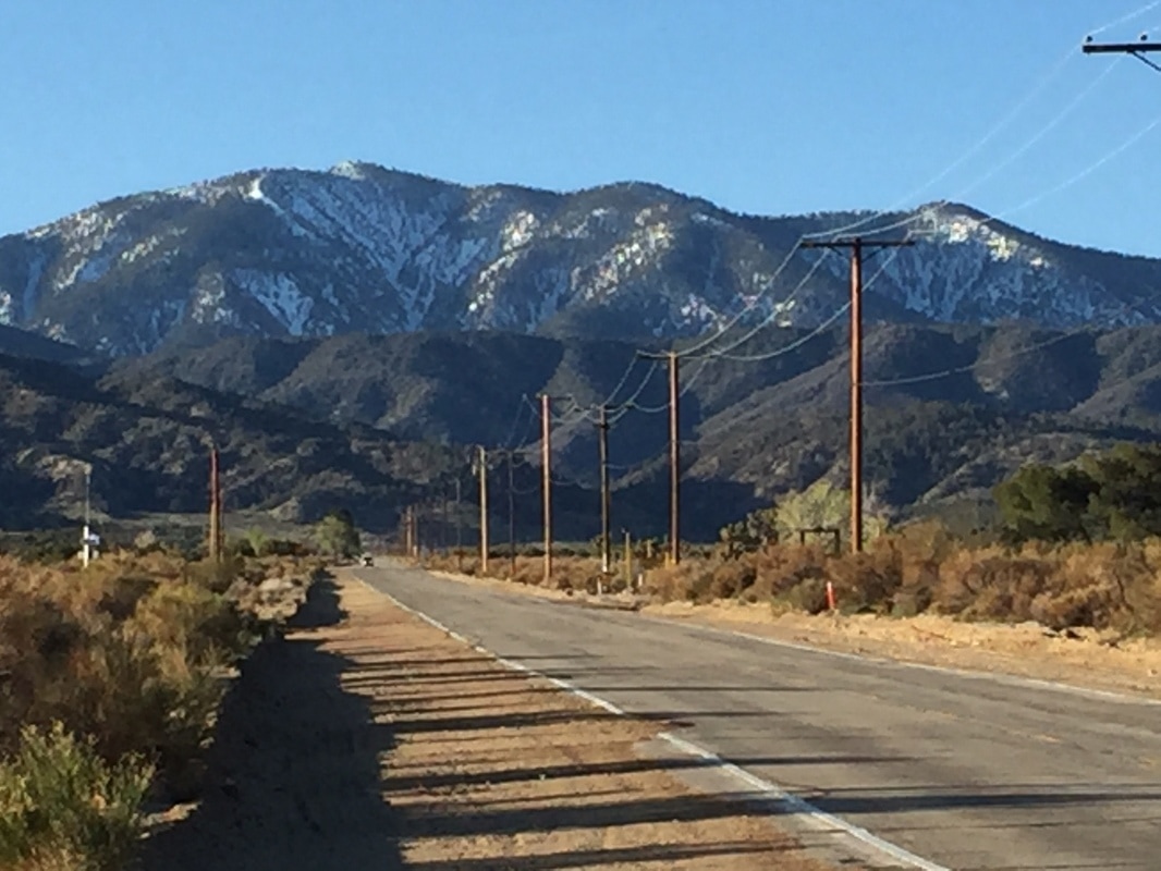
Snowpack Observer Tony Bird Keep me anonymous if published no Location (general area) Mt. Baden-Powell Date (yyyymmdd) 20170329 Time daytime Road conditions to area bare Temperature low 50s Sky clear (no clouds) Wind speed Calm (smoke rises vertically) Wind direction not observed Slope aspect North Slope angle up to 38 Elevation 8,000+ Snow depth 5 feet+ Boot/ Ski penetration shallow Precipitation None Activity, recent avalanches No Whumphing noises, shooting cracks. collapsing no Rapid warming no Obvious avalanche path yes Terrain trap yes Comment March 29, 2017 Mt. Baden-Powell Report by Tony Bird Photos by Jenny Lo Baden-Powell proved both disappointing and dangerous on several counts this day, some of them our own fault. The mountain still has plenty of northside snow, so it ought to be ripe for descents at least a couple more weeks to come. However the snow is gone from The Snake couloir, reported here a couple weeks ago, and although snow still fills the upper North Couloir, the exit is bad news, as we found. The only good descent is one which I call Avalanche Couloir. Since avalanche danger is close to zero, don't let the name dissuade you, although that could change. I observed an avalanche there in early May one year, triggered by some aggressive skiers in the party ahead of me. It was a healthy sluff-slide--eight inches of fresh snow on top of the winter hardpack. No one hurt, the runout only about 18 inches deep, but potentially dangerous for physical injury. If it gets fresh snow, beware. For this trip, Avalanche Couloir would have been the key to a much better ski descent. Another party on the mountain did it right, ascending the couloir from Angeles Crest Highway so they could find their way back to it through the dense forest above it. The beginning of Avalanche Couloir is easy to find: hike about a half-mile up the highway from the closure point at Vincent Gap. You will round a bend, encountering steep cliffsides most of the way. Keep looking uphill. Avalanche Couloir currently has snow down to about 200 yards above the highway. Up above it you will see a wide, steep snowfield with sparse coverage by young trees, its starting zone. Continue a hundred yards further down ACH and you find the obvious drainage, now a lively creek, of Baden-Powell's main North Couloir. Both of these north-facing features are visible from Antelope Valley. If you come that way, study them on your way in. I suggest avoiding North Couloir at all costs. It took some real rockclimbing skills--in ski boots on crumbly rock--to get through the exit and its waterfalls without slipping. We were glad we started early enough to get out before dark. We had ascended the regular hiking route from Vincent Gap. No snow coverage for the first half mile of trail and then rather difficult conditions thereafter. I found the snowpack disappointingly hard--could not kick deep enough for good support on my tele boots and wound up edging most of it. It was well after 12 pm when the snow became more penetrable. We both employed whippets on one of our ski poles and made use of them several times. Due to difficulties in the ascent, which admittedly included experimenting with some equipment options, we did not go as far as the summit ridge. We started our descent shortly before 2 pm a bit below the summit ridge, intending to find Avalanche Couloir, staying just east of North Couloir but eventually being tempted down into it. It apparently had plenty of snow, but that changed abruptly after a short bit of pleasant skiing. After we finally got out of this little nightmare and started down ACH we looked up at Avalanche Couloir, a mere hundred yards east of the North Couloir exit. We felt like kicking ourselves--what a pleasant ski run that might have been! Publish this observation Yes I would like this observation Published |
North Couloir leads down from the large delta field below Baden-Powell summit. Avalanche Couloir leads down from the small field, lower and to the left of North Couloir.
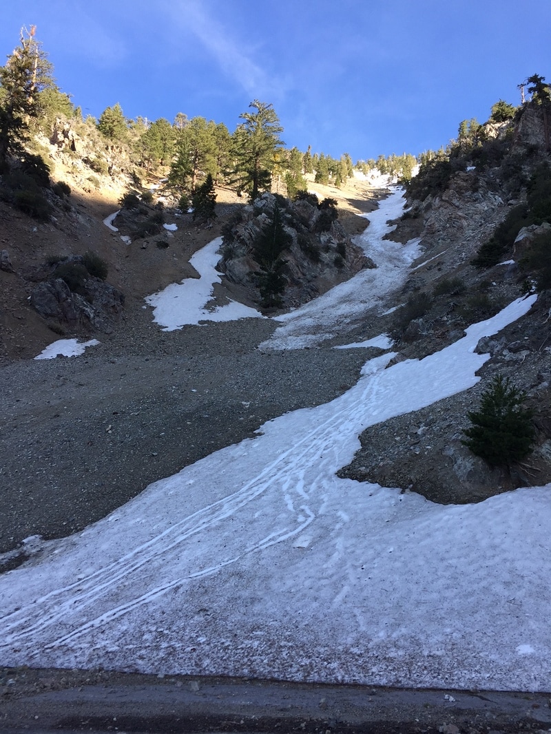
Looking up Avalanche Couloir from Angeles Crest Highway.
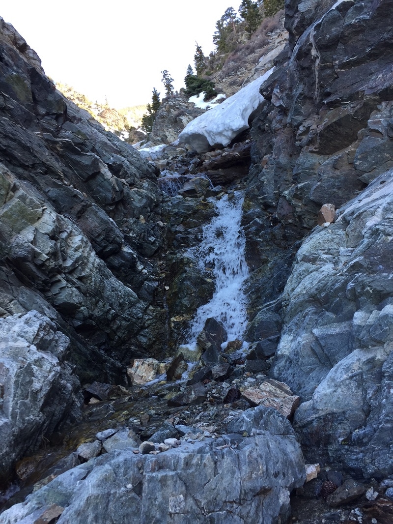
we managed to downclimb this waterfall, but the one below it required 3rd classing up the ramp towards the right.
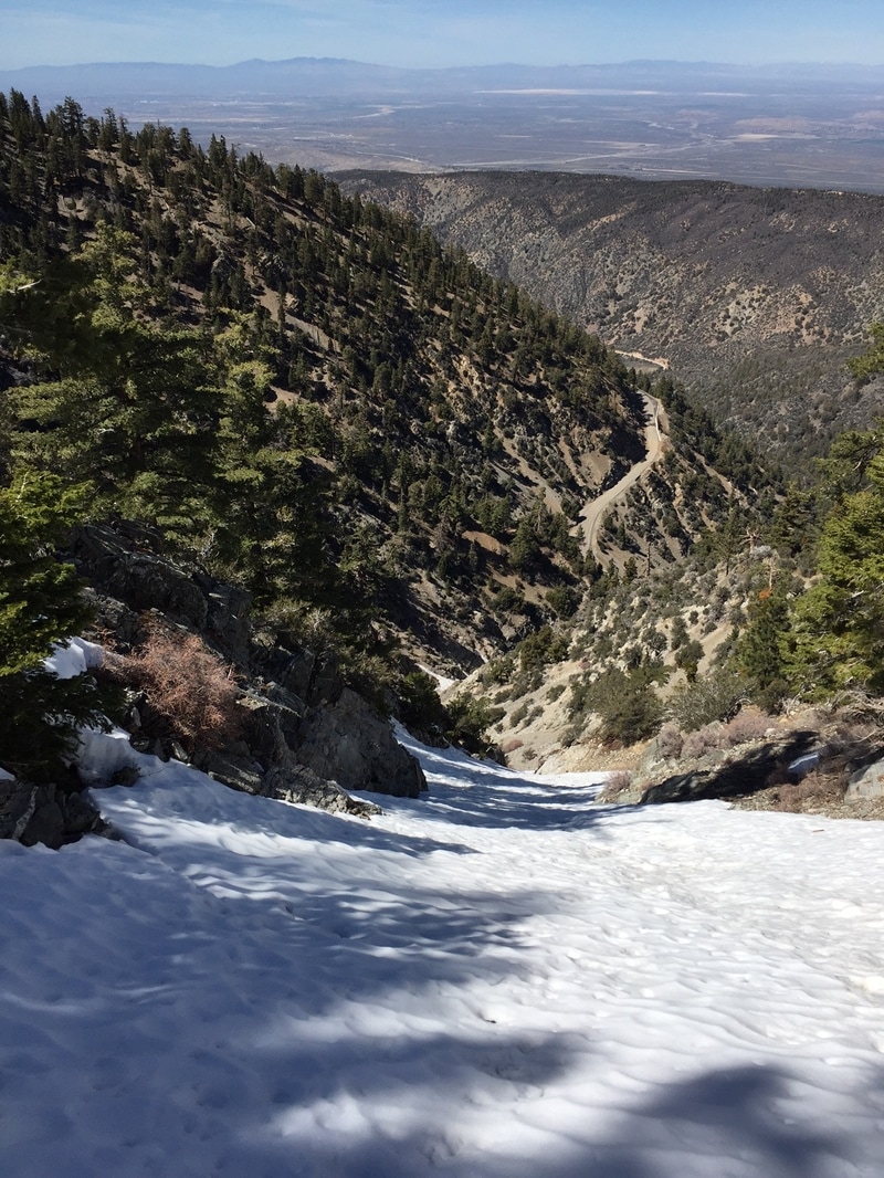
this was the last of the good skiing on the eastern side of north couloir. it ended abruptly with rock which required considerable scouting and downclimbing.
|
Sponsors
|
|
|
|

|

|

|

|

|

|

|
|

|
|
|
|

|

|
Supporters
|
|
|
|

|
|
© 2013 - 2015 So Cal Snow Avalanche Center inc. All rights reserved.
P.O.Box 214 Tujunga, Ca. 91043 |
A 501(c)3 non profit organization # 46-2296801
|
Use at your own risk. This information is provided “as is” and in no event shall the providers be liable for any damages, including, without limitation, damages resulting from discomfort, injury or death, claims by third parties or for other similar costs, or any special, incidental, or consequential damages, arising out of the use of the information.