|
|
Your Support Helps
|
|
Snowpack Summary March 16, 2024
Posted by Allen Giernet @ 5:44 am (this summary expires in 24 hours)
This summary applies to backcountry areas only.
The Bottom Line –
Expect significantly different conditions in our mountain ranges today:
- San Gabriel Mountains - Fast Firm Icy conditions will be the main concern with slide for life hazards. Variable surface conditions with a dusting of snow may require sharp pointy tools for travel in the mountains. Assess your abilities and the conditions you are presented with. Reduce this hazard by choosing lower angle slopes and being aware of what is below you that could increase the consequences of a slip and fall. Warming expected to begin Sunday and rapidly increase next week will bring on Wet Loose avalanche problems.
- San Bernardino Mountains - Wind Slab and Storm Slab avalanches will be the concerns today with human triggered avalanches possible. 13" of snow has been reported in the last 24 hours at the 8,000' elevation. Moderate Northerly winds for the past 24 hours will have transported snow into Southerly aspects. By sticking to lower angle slopes < 30°, wind sheltered areas and avoiding leeward slopes you can reduce your exposure to these hazards. Wind Slabs will be possible on SE, S, SW aspects below ridges and along gullies and could be found on other aspects. Looks for signs of wind drifted snow. Pillowed snow surfaces, wind scouring, cornices, sculpted snow and blowing snow to indicate areas of wind transport. Storm slabs will be possible on all aspects above 7,000' and can be avoided by sticking to terrain < 30°.
We are still operating on very limited on the ground data. If you are venturing out share any information you gather to [email protected] as our observation page has been malfunctioning.
San Gabriel Mountains
Firm and Icy Surfaces firm and icy surfaces can cause long slide for life
scenarios. Travel can be difficult to very dangerous. Self arrest may be
difficult to impossible. Micro spikes are not recommended for these
conditions. Ice Axe and Crampons with proper training and skill are
necessary tools for travel in these conditions. A slip and fall on these
surfaces can lead to a long slide with tragic results.
San Bernardino Mountains

Wind Slab avalanches are the release of a cohesive layer of snow (a slab) formed by the wind. Wind typically transports snow from the upwind sides of terrain features and deposits snow on the downwind side. Wind slabs are often smooth and rounded and sometimes sound hollow, and can range from soft to hard. Wind slabs that form over a persistent weak layer (surface hoar, depth hoar, or near-surface facets) may be termed Persistent Slabs or may develop into Persistent Slabs.
Storm Slab avalanches are the release of a cohesive layer (a slab) of new snow that breaks within new snow or on the old snow surface. Storm-slabs typically last between a few hours and few days (following snowfall). Storm-slabs that form over a persistent weak layer (surface hoar, depth hoar, or near-surface facets) may be termed Persistent Slabs or may develop into Persistent Slabs.
General discussion
Dynamically different scenarios are to be expected in our mountain ranges today.
The San Bernardinos have received over 12" of snow in a 24 hour period combined with moderate Northerly winds. Wind slab and Storm Slab avalanches will be possible to be triggered by humans. Generally they will not be large enough to bury you but can easily knock you off your feet and take you into terrain with significant consequences. With the right conditions they could be large enough to bury a person. Manage your exposure by sticking to wind sheltered terrain and avoiding slopes >30° until snow has a chance to settle. There is a chance for a few more inches of snow today.
In the San Gabriel Mountains significant winds earlier this week have created variable surface conditions with Firm Icy surfaces being the greatest hazard at this time. Slide for life scenarios are likely in steeper terrain and can result in tragic outcomes when significant hazards are below you. Use the proper tools and skills to travel in these conditions, avoid steep exposed slopes and be aware of what is below you. If you are not certain of your abilities or the conditions turn around before you get into a situation you can't retreat from. A light dusting of snow was reported from yesterday and cold temps along with cloud cover are forecast for today and will maintain these concerns. You may find good snow in wind sheltered areas.
All mountain ranges in our zone are expected to have significant warming starting Sunday with little to no overnight freezes during the week next week. If this forecast holds true expect Wet Loose avalanches to become likely and potentially large in areas with significant snow. Cornices will become unstable and can release unexpectedly during the warm periods and potentially release avalanches on slopes below them.
Please share any information when you are out in the mountains. Even a photo is helpful. Submit observations to socalsnow.org as our observation page is malfunctioning.
|
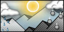
General Mountain Weather Forecast |
Weather Page Link
Click on the links below for the latest information
Click here for this Season's Snow Pack Summaries
To better understand the challenges and potential variability over the large area we are producing information for please read our Snowpack Summary - Format and Limitations
Disclaimer:
This Bulletin is designed to generally describe conditions where local variations always occur. Travelers are advised to exercise caution and make slope specific evaluations. As always, please treat this bulletin with appropriately guarded skepticism and make your own assessments. Help to provide more information to the community by reporting your observations
This Bulletin is designed to generally describe conditions where local variations always occur. Travelers are advised to exercise caution and make slope specific evaluations. As always, please treat this bulletin with appropriately guarded skepticism and make your own assessments. Help to provide more information to the community by reporting your observations
Latest Observtions
Click on the observation to go to the full report
|
Observation type
Snowpack Location - Angeles Crest Date (yyyymmdd) -20230505 Comment May 5th, 2023.. Cinco De Mayo report on Angeles Crest.. NE aspect @ 8,000’ 15cm new snow Total snow depth. 195cm NE aspect @ 8500’ 20 cm new snow Total snow depth. 215cm N aspect @ 8800’ 35cm new snow Total snow depth. No bottom >280cm N aspect @ 9400’ 45-55cm new snow Total snow depth. No bottom >280cm Before 11-1200 snow was surprisingly light, dry but transitioning fast, and by 1400 it was rollerball and pinwheel city. Evidence of wet slides below 8k on east aspects affected by long hours in the sun. Temps were downright cold early, cool and mild mid day, but high May sun angle cooked the snow quick, and above 8k is now turned to hot pow and below 8k was lovely mank. |
Observation type -
Snowpack Location - Mt. Burnham - San Gabriels Date (yyyymmdd) - 20230423 Comment - April 22-23 2023 Long hauled 9 miles west of big pines for an overnight trip on the closed ACH. PCT hikers have just started to come through the area leaving somewhat of a worn path through still extremely deep avalanche run outs over the bench of ACH. The highway is still remarkably buried deep from BP to our destination 3 miles west of VG and beyond. Deepest is approx 25’+ under MB, which leads me to believe that we may not see ACH open until mid summer or not at all. The myriad of avalanche debris that are just now revealing themselves through the spring thaw is extensive and impressive. Above average temps and little to no refreeze below 9k yielded variable snow surfaces from hard fast firm to shin/knee penetration, even with ascension plates. Shallow glide cracks near and between steeper rock outcroppings were observed on some of the steeper north aspects approx 3-4’ deep. Wet loose instability was observed over the warm weekend will only small rider triggered slides no longer than the width of our boards on descent, and none of which ran further than 10-15’. There are still overhanging cornices that have yet to fail even under the late April sun angle and warm temps. Great corn to harvest when your descents are timed well. |
Observation type
Avalanche Location - Mt. Baldy Bowl Date (yyyymmdd) - 20230423 Comment - Wet loose debris noted toward skiers right of Baldy bowl. Another hiker told me he saw the avalanche happen around 6am. Fairly small and not destructive, but still something you wouldn’t want to be caught in. |
Observation type
Avalanche Location - Telegraph Peak Date (yyyymmdd) - 20230402 Comment - This wet slide occurred 4-11 afternoon @ 1:30 pm enroute to ski Telegraph peak. We had left the top of chair 3 and I was traversing towards The saddle of Telegraph peak when a significant crack occurred under my skis. I was able to maintain a traverse towards the trees and avoided getting caught! I thought it might be useful information if anyone is going to be skiing in the Telegraph peak area. |
General Caution
You should always use safe terrain management and carry avalanche rescue equipment in the backcountry. Most avalanches are triggered by someone in the party or the victim. Practice with your rescue gear often and be prepared should the worst happen. Though we do not have an avalanche forecast center in this area as of yet, the information posted and shared here as well as the resources available on this site will help to make informed decisions for your backcountry travels. Use avalanche forecasts in your travels wherever available and be aware that avalanche ratings are general information. Elevation, location, geographic variability’s, slope aspect and angle all have effects on the particular area you travel in. This is only one piece of the information you should use in your decision making process. There is no substitute for avalanche education, for more resources and information as well as education please refer to our resources page.
You should always use safe terrain management and carry avalanche rescue equipment in the backcountry. Most avalanches are triggered by someone in the party or the victim. Practice with your rescue gear often and be prepared should the worst happen. Though we do not have an avalanche forecast center in this area as of yet, the information posted and shared here as well as the resources available on this site will help to make informed decisions for your backcountry travels. Use avalanche forecasts in your travels wherever available and be aware that avalanche ratings are general information. Elevation, location, geographic variability’s, slope aspect and angle all have effects on the particular area you travel in. This is only one piece of the information you should use in your decision making process. There is no substitute for avalanche education, for more resources and information as well as education please refer to our resources page.


