Snowpack Summary January 9, 2023
Posted by Allen Giernet @ (this summary expires in 24 hours)
This summary applies to backcountry areas only.
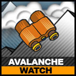
AVALANCHE WATCH – Travel into avalanche terrain is not advised
The Bottom Line –
We are still operating on limited data. Low elevation snow is thin to none as the storms have been coming through fairly warm. We have reports of 8” to 11” of snow from Jan 2 through Jan 5 at the 8,000’ elevations, with more at the higher elevations. Recent reports show 3’ + near 10,000’ in the San Bernardino Mountains. This next storm forecast is coming in with high water content and high elevation snow lines until near the end of the storm on Tuesday. With snow lines near 8,600’ through today and into tomorrow combined with near 3” of water Wet Snow avalanches are likely up to snow line in areas holding any snow. Above snow line and at the highest elevations anticipate storm slabs and with the forecast strong winds Wind Slab avalanches to develop. Travel into any areas will be difficult due to thin to no snow coverage at lower elevations and rain on snow. There will be a mix of conditions and using your own judgement and observations will be key. Adding to the problems is that it will still be early season conditions at the lower elevations with exposed obstacles so a slip and fall can bring hazardous consequences. Exercise caution if venturing out into the mountains and use avalanche protocols, travel with a partner and bring your beacon, shovel and probe.
Early season will pose many hazards besides avalanches regardless of your mountain activities rather it be a hike, snowshoeing or skiing/ boarding. Exposed obstacles and low tide conditions should be on your mind. Warming cycles followed by cold spells create firm fast and icy conditions very often in our mountains, a slip and fall in these early season conditions can be catastrophic as slide for life scenarios are some of our biggest rescue situations. Early season snowfall also brings the foundation for our base and can be the future weak layer depending upon conditions. Watch weather conditions and keep track on what is happening in the snowpack starting now and following the trends all season will help prepare you to make more informed decisions.
During this period as we wait for the snowpack to develop it is a great time to
brush up on your avalanche training or look into booking an avalanche course. There are many avalanche awareness programs throughout the country and many are virtual and free.
Please share any information when you are out in the mountains. Even a photo is helpful.
Please share your observations with us at the avalanche center Submit Reports page.
General Caution
General Summary
Travel into avalanche terrain not advised
Exercise caution on slopes over 30° as these conditions will exist throughout all mountain ranges. Always exercise caution when entering into winter mountain areas. Bring a Beacon Shovel and Probe and know how to use them. Travel with a partner and make conservative decisions.
General Mountain Weather Forecast |
Daily forecasts coming soon
Click on the links below for the latest information
Click here for this Season's Snow Pack Summaries
To better understand the challenges and potential variability over the large area we are producing information for please read our Snowpack Summary - Format and Limitations
Disclaimer:
This Bulletin is designed to generally describe conditions where local variations always occur. Travelers are advised to exercise caution and make slope specific evaluations. As always, please treat this bulletin with appropriately guarded skepticism and make your own assessments. Help to provide more information to the community by reporting your observations
This Bulletin is designed to generally describe conditions where local variations always occur. Travelers are advised to exercise caution and make slope specific evaluations. As always, please treat this bulletin with appropriately guarded skepticism and make your own assessments. Help to provide more information to the community by reporting your observations
Latest Observtions
Click on the observation to go to the full report
|
Observation type
Snowpack Location - Mt. Islip Date (yyyymmdd) -20230102 Comment North slopes in the area were barely covered enough to skin and ride. Rideable surfaces were limited to designated trails and fire roads where rocks, trees, and shrubs are cleared at the base. South facing slopes were almost completely bare in the area. My rough snow pit observation showed three general layers spanning the 21 cm depth. 0-14 cm was pencil hard (early season melt-freeze layer), 14-17 cm was one finger hard, 17-21 cm was 4 finger hard (new dusting likely from New Years Eve). |
Observation type
Snowpack Location - Mt. Pinos Summit Date (yyyymmdd) - 20221111 Comment - Comment Powder lingering well from the storm earlier in the week, coverage in summit area quite skiable. |
Observation type
Snowpack Location - Wrightwood Date (yyyymmdd) - 20221109 Comment - First snowstorm of the season rolled through the Eastern San Gabriel mountains late Tuesday 11/8 after a day of torrential rain and wind (~4in liquid per my station, 60mph gusts) that came in warmer than originally forecast. Storm switched over to snow at roughly 7pm on Tuesday evening and cleared out before sunrise Wednesday. Snow totals at 2000m were 6cm of dense, high-moisture white stuff. Reports of 12cm from 2400m on the ridge above. Not bad, considering it's still early November, but a shame the storm didn't come in a few degrees cooler and with more snow. I'll get out this weekend for some exploration on the ridgelines to see how much loaded up on the Northern leeward slopes. |
General Caution
You should always use safe terrain management and carry avalanche rescue equipment in the backcountry. Most avalanches are triggered by someone in the party or the victim. Practice with your rescue gear often and be prepared should the worst happen. Though we do not have an avalanche forecast center in this area as of yet, the information posted and shared here as well as the resources available on this site will help to make informed decisions for your backcountry travels. Use avalanche forecasts in your travels wherever available and be aware that avalanche ratings are general information. Elevation, location, geographic variability’s, slope aspect and angle all have effects on the particular area you travel in. This is only one piece of the information you should use in your decision making process. There is no substitute for avalanche education, for more resources and information as well as education please refer to our resources page.
You should always use safe terrain management and carry avalanche rescue equipment in the backcountry. Most avalanches are triggered by someone in the party or the victim. Practice with your rescue gear often and be prepared should the worst happen. Though we do not have an avalanche forecast center in this area as of yet, the information posted and shared here as well as the resources available on this site will help to make informed decisions for your backcountry travels. Use avalanche forecasts in your travels wherever available and be aware that avalanche ratings are general information. Elevation, location, geographic variability’s, slope aspect and angle all have effects on the particular area you travel in. This is only one piece of the information you should use in your decision making process. There is no substitute for avalanche education, for more resources and information as well as education please refer to our resources page.


