 follow us on instagram
Now get our bulletin and daily weather forecast on facebook and Instagram
Please support the Center. Your donations are important to keeping this program going and bringing you more resources in the future.
Please support the Center. Your donations are important to keeping this program going and bringing you more resources in the future.
|
|
2-3-18 Today will be much like yesterday with temperatures within a degree or two and tomorrow will be much like the next day and so on. Skies will be mostly clear with light to moderate Northeast to Easterly winds. ••• The previous forecast discussion ••• A high pressure ridge will be sitting on top of So Cal maintaining warm dry conditions with temps hanging above seasonal averages through the middle of next week.
Hint: for historical weather forecast data use our facebook page as all posts are there on a running timeline. For more details check each areas forecast and weather stations for most current information. Snowpack Summary May 29, 2017
Posted by Allen Giernet @ 8:58am This summary applies to backcountry areas only. The Bottom line The snow is quickly diminishing and the locations where you are able to get any substantial snow are very few and generally remote. Expect variable conditions from firm slide for life conditions in the morning and in sheltered areas to soft and unsupportable saturated snow due to the overall warm weather. A slip on firm snow surfaces or a wet loose release due to saturated snow will both lead to sliding down slope on thin snow coverage with numerous obstacles that may cause injury or could prove to be fatal. Be aware of whats below you and the changing conditions of any substantial snow you are on. This will be our last post for this season. For the remainder of the season Variable conditions will continue throughout the mountains at this time of year. Be prepared for quickly changing conditions as you travel and constantly reassess the conditions around you. Be sure you are properly equipped and aware of the changing conditions to prevent getting into a location you can’t retreat from. Our mountain weather will continue to be updated regularly and if your not familiar with it there is a climbing weather page on the site for point forecasts to all the local and surrounding crags. Please continue to visit the center and watch for upcoming events. There will be something happening mid summer. Don’t miss it! General Summary It has been a phenomenal season for So Cal and we would like to thank everyone for their participation in our program and events this season. We would also like to thank the National Ski Patrol, The San Jacinto State Park Rangers, The SCSAC board of directors, Snow Valley, Mountain High, Mt Baldy, Sand Diego and Oxnard NOAA offices and all of our fantastic sponsors for their incredible support and help. We are closing down the season after we have issued 24 snowpack summaries, had over 60 students in avalanche level 1 courses, 5 in avalanche level 2 courses and over 400 people in our Avalanche Awareness courses. In closing we still need to raise enough funds to get our first high elevation weather station in place for Southern California. If everyone that used our various forms of information was to donate $10 we would have more than adequate funds to make this happen. For everyone that donates $30 we will put you into a drawing for an Avalanche Level 1 course for the 2017/ 2018 season. All $30 donations received by June 16 will be entered and the winner will be announced on June 19. Thanks again to everyone for making this a fantastic season. As noted above our mountain specific weather information and climbing crag weather page will be useful all year long so please continue to use this resource and happy wanderings this summer. Variable conditions will continue throughout the mountains at this time of year. Be prepared for quickly changing conditions as you travel and constantly reassess the conditions around you. Be sure you are properly equipped and aware of the changing conditions to prevent getting into a location you can’t retreat from. Always practice use of avalanche skills when entering avalanche terrain and on steep slopes. Travel with a partner, use proper safe travel practices and carry a beacon shovel and probe. Most importantly know how to use them! To better understand the challenges and potential variability over the large area we are producing information for please read our Snowpack Summary - Format and Limitations Snowpack Summary - Format and Limitations Avalanche Concern #1
Wet Loose avalanches are the release of wet unconsolidated snow or slush. These avalanches typically occur within layers of wet snow near the surface of the snowpack, but they may quickly gouge into lower snowpack layers. Like Loose Dry Avalanches, they start at a point and entrain snow as they move downhill, forming a fan-shaped avalanche. Other names for loose-wet avalanches include point-release avalanches or sluffs. Loose Wet avalanches can trigger slab avalanches that break into deeper snow layers.
Small human triggered wet loose avalanches may be possible with the warm temperatures. Snow will become saturated each day as the day warms. Be aware of rapidly changing conditions through the day. Use caution on slopes greater then 30° where you can find snow. Be aware of the rising temperatures and changing weather as you travel. Slopes softening will be dependant on many factors. Aspect will affect the sun exposure as warming will begin in the east and travel to the west during the day and even Northern aspects will receive more sun exposure as the spring sun climbs higher in the sky. Elevation - as temperatures will affect lower elevations earlier and progress to higher elevations. Cloud cover can increase warming by trapping in terrestrial radiation but can limit solar radiation causing more softening on northern slopes and less on sun exposed slopes. Winds can maintain cooler conditions at the snow surface on the windward aspects. Softening can be intensified near cliffs and rock outcroppings, be aware of sinking deep into the snow as a sign the snow is becoming unstable. Adjust your plans accordingly to these changes in the snowpack
Disclaimer:
This Bulletin is designed to generally describe conditions where local variations always occur. Travelers are advised to exercise caution and make slope specific evaluations. As always, please treat this bulletin with appropriately guarded skepticism and make your own assessments. Help to provide more information to the community by reporting your observations Latest Observtions
|

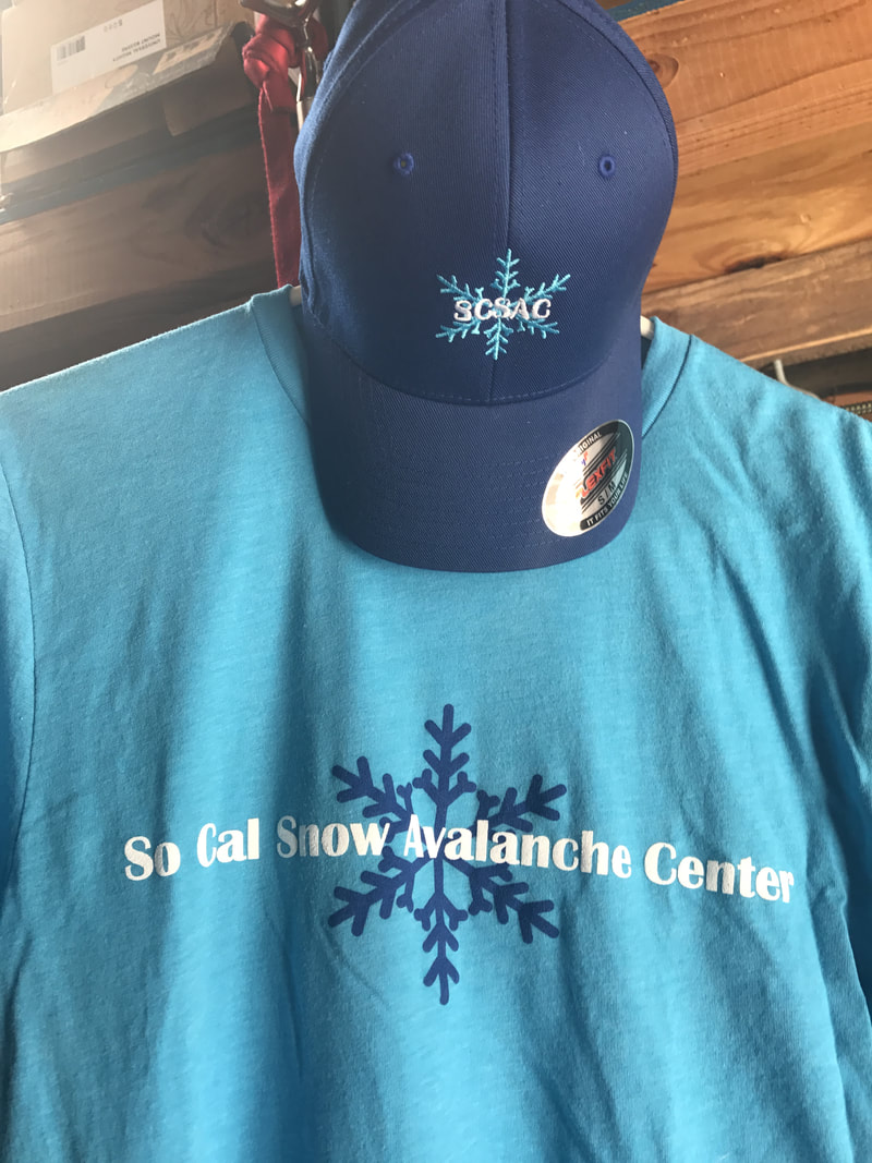
SCSAC T-shirts and Hats now available
for the 2017/ 2018 season with donation


Fundraising
campaign
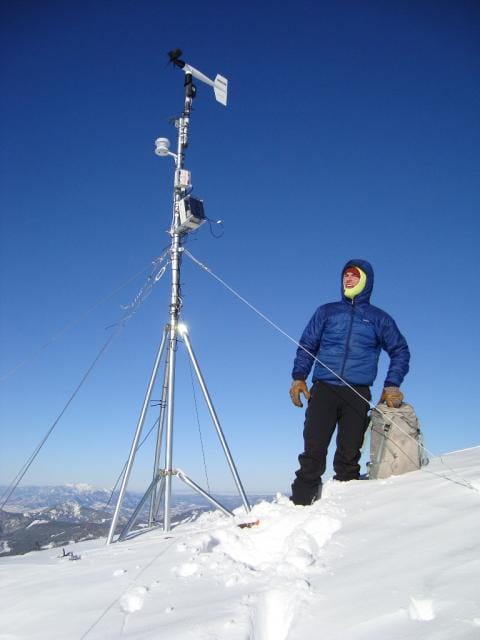
We are raising funds to purchase and install the first of several weather stations at remote locations in our local mountains. This will bring us much needed pertinent data from above snow line that we doe not have reliable resources for. Satelite link up will bring us snow depth and amounts, along with wind, temperature and much more and will be available to the public.
Our goal is to raise $10,000 to purchase the equipment, cover installations costs and provide for a much needed overhaul of the website.
Please contribute to make this a reality for us all. Click on the donate button below and come out to join our annual fundraiser event at Mt. Baldy
Goal: $10,000 Recieved: $2,500.00
For more information go to the Fundraiser Program page
campaign
We are raising funds to purchase and install the first of several weather stations at remote locations in our local mountains. This will bring us much needed pertinent data from above snow line that we doe not have reliable resources for. Satelite link up will bring us snow depth and amounts, along with wind, temperature and much more and will be available to the public.
Our goal is to raise $10,000 to purchase the equipment, cover installations costs and provide for a much needed overhaul of the website.
Please contribute to make this a reality for us all. Click on the donate button below and come out to join our annual fundraiser event at Mt. Baldy
Goal: $10,000 Recieved: $2,500.00
For more information go to the Fundraiser Program page
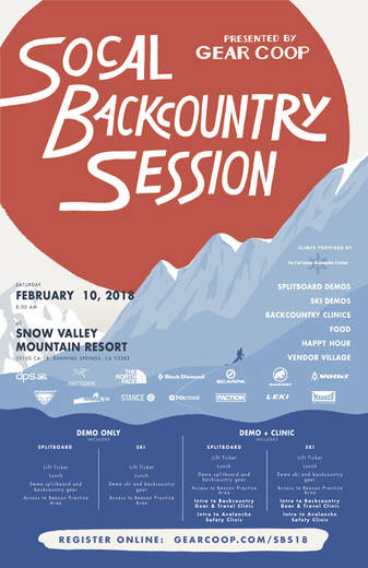
2017/18 Events
The Avalanche Center
The Avalanche Center
So Cal snow Fest SCSAC Fundraiser
Free Avalanche
Awareness
Presentations:
Everyone is welcome
California State
University
San Marcos
TBA
In the REC center /
Clarke Field House 333 S. Twin Oaks Valley Rd., San Marcos, CA 92096
Claremont College Outdoor Education Center
601 Amherst Av.
Claremont, Ca. 91711
TBA
The Adventure 16
Free Avalanche
Awareness series
Happy half hour 6:30pm
Presentation 7:00pm
January TBA, 2018
Adventure 16 San Diego
4620 Alvarado Canyon Rd.
San Diegeo, CA, 92120 USA
January TBA, 2018
Adventure 16 Tarzana
5425 Reseda Blvd.
Tarzana, CA, 91356 USA
January TBA, 2018
Adventure 16 West L.A.
11161 W. Pico Blvd.
Los Angeles, CA, 90064 USA
Future dates and events TBA soon be sure to visit the events page for updates and details
Free Avalanche
Awareness
Presentations:
Everyone is welcome
California State
University
San Marcos
TBA
In the REC center /
Clarke Field House 333 S. Twin Oaks Valley Rd., San Marcos, CA 92096
Claremont College Outdoor Education Center
601 Amherst Av.
Claremont, Ca. 91711
TBA
The Adventure 16
Free Avalanche
Awareness series
Happy half hour 6:30pm
Presentation 7:00pm
January TBA, 2018
Adventure 16 San Diego
4620 Alvarado Canyon Rd.
San Diegeo, CA, 92120 USA
January TBA, 2018
Adventure 16 Tarzana
5425 Reseda Blvd.
Tarzana, CA, 91356 USA
January TBA, 2018
Adventure 16 West L.A.
11161 W. Pico Blvd.
Los Angeles, CA, 90064 USA
Future dates and events TBA soon be sure to visit the events page for updates and details
National Ski
Patrol - Local
Claremont Calif. L.A.
Level 1 Class sessions
Registration
6pm - 10pm
January 9th & 11th
Level 2 class sessions
Returning in 2019
Field Sessions
(subject to snow conditions)
January 20th & 21st
February 10th $ 11th
March TBA
Sierra Mountain
Center
Bishop, Ca
Level 1 classes
2017/18 dates are up
Level 2 class
2017/18 Dates are up
Sierra Mountain
Guides
Bishop, Ca.
Level 1 classes
2017/18 Dates are up
Level 2 class
2017/18 Dates are up
Sierra
Mountaineering
International
Bishop, Ca
Level 1 classes
2017/18 Dates are up
Level 2 classes
2017/18 Dates are up
For the current curriculum visit
the AAI & AAIRE
websites
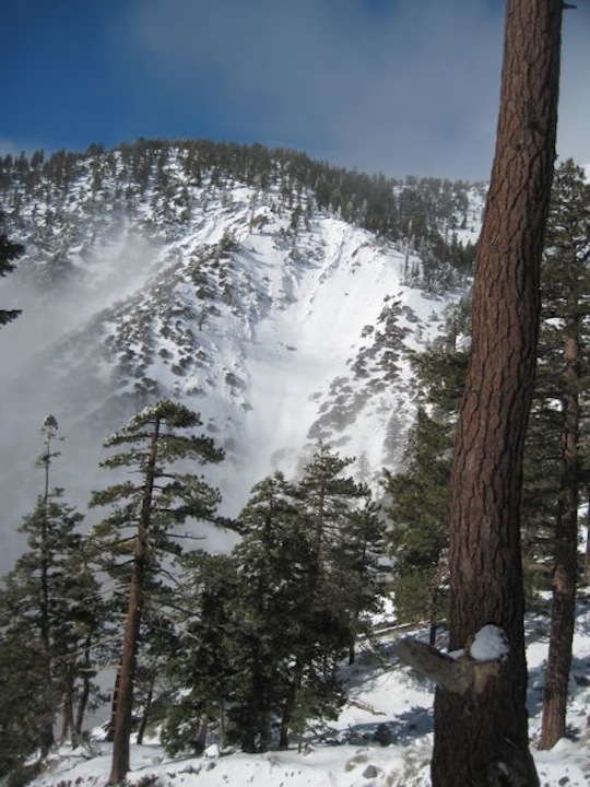
Slide path in the San Gabriel mountains
Awareness
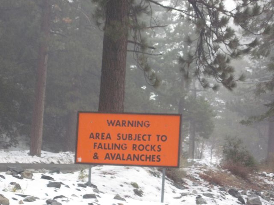
There are avalanches in So Cal. This sign is on the road just before Mt. Baldy trailhead
General Caution
You should always use safe terrain management and carry avalanche rescue equipment in the backcountry. Most avalanches are triggered by someone in the party or the victim. Practice with your rescue gear often and be prepared should the worst happen. Though we do not have an avalanche forecast center in this area as of yet, the information posted and shared here as well as the resources available on this site will help to make informed decisions for your backcountry travels. Use avalanche forecasts in your travels wherever available and be aware that avalanche ratings are general information. Elevation, location, geographic variability’s, slope aspect and angle all have effects on the particular area you travel in. This is only one piece of the information you should use in your decision making process. There is no substitute for avalanche education, for more resources and information as well as education please refer to our resources page.
You should always use safe terrain management and carry avalanche rescue equipment in the backcountry. Most avalanches are triggered by someone in the party or the victim. Practice with your rescue gear often and be prepared should the worst happen. Though we do not have an avalanche forecast center in this area as of yet, the information posted and shared here as well as the resources available on this site will help to make informed decisions for your backcountry travels. Use avalanche forecasts in your travels wherever available and be aware that avalanche ratings are general information. Elevation, location, geographic variability’s, slope aspect and angle all have effects on the particular area you travel in. This is only one piece of the information you should use in your decision making process. There is no substitute for avalanche education, for more resources and information as well as education please refer to our resources page.


