|
|
Your Support Helps
|
|
|
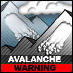
Avalanche Warning
REMAINS IN EFFECT Travel in avalanche terrain is not advised |
Snowpack Summary March 1, 2023
Posted by Allen Giernet @ 10:00 am (this summary expires in 24 hours)
This summary applies to backcountry areas only.
The Bottom Line –
Updated avalanche danger warning! Due to significant snowfall from the past several storms. Reports of 6’-8’+ accumulation at resort levels on Monday, another 1’ to 2’ from the last storm and numerous reports of large natural avalanches mandates that travel into, near or beneath avalanche terrain is not advised at this time ! If you can get into the mountains use extreme caution. There are still reports of more snow falling. This is an unusual amount of snow for our mountains combined with moderate to high SW to W winds expect Storm Slab and Wind Slab Avalanches to be Likeley and large in areas. Higher elevations terrain will have received more snow increasing potential danger.
Please share your observations with us at the avalanche center Submit Reports page.

Wind Slab avalanches are the release of a cohesive layer of snow (a slab) formed by the wind. Wind typically transports snow from the upwind sides of terrain features and deposits snow on the downwind side. Wind slabs are often smooth and rounded and sometimes sound hollow, and can range from soft to hard. Wind slabs that form over a persistent weak layer (surface hoar, depth hoar, or near-surface facets) may be termed Persistent Slabs or may develop into Persistent Slabs.

Storm Slab avalanches are the release of a cohesive layer (a slab) of new snow that breaks within new snow or on the old
snow surface. Storm-slabs typically last between a few hours and few days (following snowfall). Storm-slabs that form over a
persistent weak layer (surface hoar, depth hoar, or near-surface facets) may be termed Persistent Slabs or may develop into
Persistent Slabs.
snow surface. Storm-slabs typically last between a few hours and few days (following snowfall). Storm-slabs that form over a
persistent weak layer (surface hoar, depth hoar, or near-surface facets) may be termed Persistent Slabs or may develop into
Persistent Slabs.
General Summary
#1 Wind slab avalanche – Will be likely and large at the upper elevations on NE and E aspects and possible on all aspects below ridgelines and on sides of gullies. Look for signs of wind drifted snow. Actual blowing snow, sculpted snow, scoured ridges and cornices, pillowed snow and firmer hollow sounding snow. These are all signs of wind loaded snow. If you encounter these signs avoid pillowed areas of snow or stick to lower angle terrain below 30°.
#2 Storm slab avalanche – Storm slabs will be likely and have large natural avalanches and have been observed already. Due to copious amounts of snow expect to find these conditions on all aspects and increasing in danger and size as you gain elevation. Travel into near or beneath avalanche terrain is not advised at this time.
Exercise caution if venturing out into the mountains and use avalanche protocols, travel with a partner and bring your beacon, shovel and probe.
Please share any information when you are out in the mountains. Even a photo is helpful. Submit observations to Submit Reports page.
|
General Mountain Weather Forecast |
Weather Page Link
Click on the links below for the latest information
Click here for this Season's Snow Pack Summaries
To better understand the challenges and potential variability over the large area we are producing information for please read our Snowpack Summary - Format and Limitations
Disclaimer:
This Bulletin is designed to generally describe conditions where local variations always occur. Travelers are advised to exercise caution and make slope specific evaluations. As always, please treat this bulletin with appropriately guarded skepticism and make your own assessments. Help to provide more information to the community by reporting your observations
This Bulletin is designed to generally describe conditions where local variations always occur. Travelers are advised to exercise caution and make slope specific evaluations. As always, please treat this bulletin with appropriately guarded skepticism and make your own assessments. Help to provide more information to the community by reporting your observations
Latest Observtions
Click on the observation to go to the full report
|
Observation type -
Snowpack Location - Wrightwood Date (yyyymmdd) - 20230220 Comment - Leisurely afternoon trek up the ridge for some surface condition scouting and beacon practice before the mega storm rolls into town. Snow coverage below 7000' is spotty, but above that on stepper N-NW aspects there is still a decent base covering most bushes and rocks. Aspects with solar input have corned up nicely. Steeper, shaded aspects in the trees have a melt/freeze crust with 4-5cm of near surface facets sitting atop the previous crust (see image). Below that is pretty much all pencil to knife hard consolidated snow. Recent warm days seem to be rounding the facets; it will be worth watching what happens as things cool down in the coming days. Biggest concern for me is the very firm crust on which the potentially huge amount of snow will fall onto. |
Observation type
Snowpack Location - San Bernardino Mtns. Alta Diablo Date (yyyymmdd) - 20230215 Comment - Comment On February 15, 2023 I skinned up the north side of Alto Diablo on my skis. I observed shooting cracks and whumps on two slopes. On one of the slopes the crack propagated about 10 feet above me and 20 to 30 feet across the slope. If this had been on a steeper slope I believe it would have released a significant slab approximately 8 - 10" deep. This appears to be an old layer that is collapsing underneath the surface crust. This was only observed at lower elevations. Use caution moving through avalanche terrain at lower north facing elevations, especially on slopes exceeding 35 degrees. Additionally there were many areas of wind loaded snow at all elevations and a lot of snow could be seen blowing off the ridges above 10,000 feet. Even though the recent storm only brought about 1 - 2" of new snow to the area, the potential for windslabs around ridge lines is currently high. Avoid slopes above 30 degrees where wind loaded snow could accumulate especially near ridge lines. |
Observation type
Snowpack Location - Mt. Charlton Date (yyyymmdd) -20230203 Comment Edgeable snow on Charlton’s couloirs, wet powder in the trees. We switched out of our skins and put on crampons 1000’ below the summit. Wind scouring on the summit but no wind loading observed on Charleton. No slide for life conditions found after 12, before 12 it definitely could have been suspect. No natural pinwheels observed but pinwheels did form from our skin track. Recent D1 wind slab avalanches observed all across Jepson’s northwest to north facing bowl just below the ridge line. A D2 sized wind slab avalanche observed on the northwest face in the Big Draw bowl below the ridge line. |
Observation type
Snowpack Location - Big Pines Date (yyyymmdd) - 20230131 Comment - Sunrise tour on Tuesday 1-31 following the Sun-Mon storm cycle. Approx 15-20cm of cold, low density (for socal) fell total above 7000ft (likely more above 8500'), mostly on a surface of firm melt/freeze crust. Temp was 15F at 7k at 0700, colder as I went higher. Temps are in the high 20s at 6400' as of 12pm Tuesday. E-NE winds were blowing steadily as I reached a N-S ridgeline, where sastrugi (see photo) and snow transport was evident. Turns down the adjacent 30deg W-NW slope were as enjoyable as anything this year. Snow was soft, cold, and right side up; did not scrape or hit bottom once. However, small pockets shallow wind slabs were forming on the lee side of the ridge (see photo), but did not propagate beyond my ski tips. I suspect higher elevation and more wind loaded areas will be of greater concern. Coverage is looking pretty good at the moment, and it will be interesting to see how the projected dry spell affects the current snowpack in the days ahead. |
General Caution
You should always use safe terrain management and carry avalanche rescue equipment in the backcountry. Most avalanches are triggered by someone in the party or the victim. Practice with your rescue gear often and be prepared should the worst happen. Though we do not have an avalanche forecast center in this area as of yet, the information posted and shared here as well as the resources available on this site will help to make informed decisions for your backcountry travels. Use avalanche forecasts in your travels wherever available and be aware that avalanche ratings are general information. Elevation, location, geographic variability’s, slope aspect and angle all have effects on the particular area you travel in. This is only one piece of the information you should use in your decision making process. There is no substitute for avalanche education, for more resources and information as well as education please refer to our resources page.
You should always use safe terrain management and carry avalanche rescue equipment in the backcountry. Most avalanches are triggered by someone in the party or the victim. Practice with your rescue gear often and be prepared should the worst happen. Though we do not have an avalanche forecast center in this area as of yet, the information posted and shared here as well as the resources available on this site will help to make informed decisions for your backcountry travels. Use avalanche forecasts in your travels wherever available and be aware that avalanche ratings are general information. Elevation, location, geographic variability’s, slope aspect and angle all have effects on the particular area you travel in. This is only one piece of the information you should use in your decision making process. There is no substitute for avalanche education, for more resources and information as well as education please refer to our resources page.


