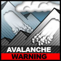
Avalanche Warning
Travel In Avalanche Terrain Is Not Advised
Travel In Avalanche Terrain Is Not Advised
Snowpack Summary March 2, 2023
Posted by Allen Giernet @ 8:30 am (this summary expires in 24 hours)
This summary applies to backcountry areas only.
The Bottom Line –
Avalanche danger will quickly increase today due to the current warm storm system. Wet slab avalanches will be likely and large as the snowpack takes on a significant amount of water today. Forecast high elevation snow lines above 10,000’ combined with heavy rainfall (1/3” / hour) and forecast precipitation totals over 3” in the San Gabriel mountains and 2” in the San Bernardino mountains will create wet snow instabilities. Travel into, near or beneath terrain over 35° is not advised. There is an unusually significant amount of snow for our area and when these type pf avalanches release they will run large and runouts will be long possibly running to well below the existing snow line. Also heavy loaded roofs will be suspect for roof avalanches and collapse due to taking on significant water weight.
Please share your observations with us at the avalanche center Submit Reports page.

Wet Slab avalanches are the release of a cohesive layer of snow (a slab) that is generally moist or wet when the flow of liquid water weakens the bond between the slab and the surface below (snow or ground). They often occur during prolonged warming events and/or rain-on-snow events. Wet Slabs can be very unpredictable and destructive.
General Summary
#1 Wet slab avalanche – Will be likely and large at all elevations on all aspects. With current forecast warm storm system high elevation snow lines abovwe 10,000’ and significant water weight adding to the snowpack quickly today will increase the probability of large wet slab avalanches. An unusually deep snowpack for Southern California will have the potential to create large avalanches as water input overloads the snow. These type of avalanches will have the potential to run much farther normal due to the amount of snow available. Wet Slab avalanches are fairly unpredictable and can be very powerful. Remain well clear of any slopes over 30° until the storm has cleared and the snow has had time to adjust to the increased load. There is more water forecast for the Northern mountains and less as you move to the southerly ranges this means the hazard is more significant the farther north you are. Access into the mountains at this time is still fairly limited and may become more limited as this storm moves through. Be aware of road closures and restrictions to allow residents and safety personnel access to their homes and communities.
Weekend Outlook – Following the rain on snow event avalanche danger will slowly settle and the snowpack will adjust over the next 24 – 48 hours. The rain on snow will likely flush a lot of instabilities out of the remaining snowpack and once colder temperatures set back in the snowpack will begin to refreeze. Expect icy surface conditions Sunday into Monday with overnight temperatures below freezing. This will bring about our most significant hazard in the local mountains of slip and fall conditions with slide for life scenarios possible, especially in the early morning hours. There is another storm with mixed rain and snow forecast for early next week.
Exercise caution if venturing out into the mountains and use avalanche protocols, travel with a partner and bring your beacon, shovel and probe.
Please share any information when you are out in the mountains. Even a photo is helpful. Submit observations to Submit Reports page.
General Mountain Weather Forecast |
Weather Page Link
Click on the links below for the latest information
Click here for this Season's Snow Pack Summaries
To better understand the challenges and potential variability over the large area we are producing information for please read our Snowpack Summary - Format and Limitations
Disclaimer:
This Bulletin is designed to generally describe conditions where local variations always occur. Travelers are advised to exercise caution and make slope specific evaluations. As always, please treat this bulletin with appropriately guarded skepticism and make your own assessments. Help to provide more information to the community by reporting your observations
This Bulletin is designed to generally describe conditions where local variations always occur. Travelers are advised to exercise caution and make slope specific evaluations. As always, please treat this bulletin with appropriately guarded skepticism and make your own assessments. Help to provide more information to the community by reporting your observations
Latest Observtions
Click on the observation to go to the full report
|
Observation type
Snowpack Location - Mt. Baden Powell Date (yyyymmdd) - 20230305 Comment - Road Mount Baden Powell right after the big storm and got one really good day of powder. Then came back two days later and the sun had already baked it and re-froze a bad firm crust on the top :( Firm snow and crust exists all the way up to 8000 feet or more. Noticed a slightly weak layer about 12 inches deep in the snow pack and did some testing and concluded it is not a major concern, though it did slide with extremely isolated and with extreme pressure on the snow pack. |
Observation type
Snowpack Location - Wrightwood Date (yyyymmdd) -20230301 Comment The epic snow event of 2023 has delivered as promised, and more. Below are some contemporaneous notes from observations at/near approximately 6,400ft in the Swarthout Valley. - Very cold, dry snow fell on 2/23 night along with gusty winds. Pockets of slabby windboard were observed on leeward slopes. - Friday 2/24 morning through Saturday 2/25 afternoon was the main event, with consistent snowfall rates of 6-9cm/hr. Best guess is snowfall ratios were 12-15:1. Totals were approx. 1.5 meters. Likely 2-3m in the high country. - Sunday 2/26 was clear and mild, with slightly above-freezing temps up to ~7000ft. Solar aspects were turning to hot pow and mank. Some - Snow and gusty winds resumed evening of 2/28, increasing in intensity overnight. By Wednesday 3/1 there was 20-30cm of new snow, with local pockets of 40-50cm in wind-loaded areas. - Several D1.5 natural avalanches were spotted on ~40deg slopes around 7300ft on 2/26. - I observed several large “whumphs” while shoveling snow from my car onto the adjacent slope, presumably from the added load. - Tl;dr – a LOT of snow has fallen in the past week, on top of variable surfaces ranging from bare earth to refrozen corn to old facets. We are now faced with a much deeper and more complex snowpack than is typical for the SoCal mountains. Roads are virtually impassable in mountain towns, so please respect residents by obeying CalTrans and CHP closures. |
Observation type
Snowpack Location - Wrightwood Date (yyyymmdd) - 20230225 Comment - Ventured out with a conservative route plan as this mega storm was winding down to see how much fell and what the snowpack is like. My partners and I toured to a ~25deg stand of oak and pine that would almost certainly never be skiable in normal years. Snow in our low-ish elevation tour seems right side up with high quality cold, dry powder rounding out the storm. Pit at ~6500ft on a 25deg North slope. 110cm deep 0-5 knife hard ice (remnants from earlier this winter) 5-55 4F 55-110 fist CT14 at 40cm, Q3 shear Snow hasn't bonded well to the icy/corn base but wasn't reactive in column test We did observe a D1 dry loose slide on a small ~40deg slope on our return home. However, there were not other observed signs of instability during our tour. |
Observation type -
Snowpack Location - Wrightwood Date (yyyymmdd) - 20230220 Comment - Leisurely afternoon trek up the ridge for some surface condition scouting and beacon practice before the mega storm rolls into town. Snow coverage below 7000' is spotty, but above that on stepper N-NW aspects there is still a decent base covering most bushes and rocks. Aspects with solar input have corned up nicely. Steeper, shaded aspects in the trees have a melt/freeze crust with 4-5cm of near surface facets sitting atop the previous crust (see image). Below that is pretty much all pencil to knife hard consolidated snow. Recent warm days seem to be rounding the facets; it will be worth watching what happens as things cool down in the coming days. Biggest concern for me is the very firm crust on which the potentially huge amount of snow will fall onto. |
General Caution
You should always use safe terrain management and carry avalanche rescue equipment in the backcountry. Most avalanches are triggered by someone in the party or the victim. Practice with your rescue gear often and be prepared should the worst happen. Though we do not have an avalanche forecast center in this area as of yet, the information posted and shared here as well as the resources available on this site will help to make informed decisions for your backcountry travels. Use avalanche forecasts in your travels wherever available and be aware that avalanche ratings are general information. Elevation, location, geographic variability’s, slope aspect and angle all have effects on the particular area you travel in. This is only one piece of the information you should use in your decision making process. There is no substitute for avalanche education, for more resources and information as well as education please refer to our resources page.
You should always use safe terrain management and carry avalanche rescue equipment in the backcountry. Most avalanches are triggered by someone in the party or the victim. Practice with your rescue gear often and be prepared should the worst happen. Though we do not have an avalanche forecast center in this area as of yet, the information posted and shared here as well as the resources available on this site will help to make informed decisions for your backcountry travels. Use avalanche forecasts in your travels wherever available and be aware that avalanche ratings are general information. Elevation, location, geographic variability’s, slope aspect and angle all have effects on the particular area you travel in. This is only one piece of the information you should use in your decision making process. There is no substitute for avalanche education, for more resources and information as well as education please refer to our resources page.
